Contents
Route description
From Steg the first stop is the mountain inn "Sücka". At Kulm turn left onto Gratweg. The trail leads over the main ridge of the Liechtenstein Alps and partly through a forest.
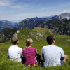
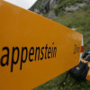
At the Goldlochspitz the ascent to the Rappenstein begins. At the summit cross a panoramic view over the Rhine Valley, the peaks of the Glarus and Appenzell Alps and, in good weather, Lake Constance awaits hikers
From the summit descend to Alp Gapfahl and then into Valünatal. The stream leads back to Steg.
Where to eat
You can stop for refreshments at the starting point of your tour, in the mountain inn "Sücka".
Interesting facts
- With an overall length of 14 km the hike is among the 5 longest hikes in Liechtenstein available on TouriSpo.
- Elevated between 1,278 m and 2,145 m, the hike is among the 3 highest elevated hikes in Liechtenstein. You're facing an uphill climb of 1000 vertical meters on this hike. This makes the hike one of the 3 hikes with the most ascent in Liechtenstein.
- Hiking boots are not required, but the hike might be more enjoyable with sturdy footwear (especially in wet conditions). If you get hungry along the way, there are places to rest and get food. Nevertheless it’s recommended to also have enough water and food in your backpack when hiking or biking.
Videos
Highlights of the tour
On beautiful days the view extends from the summit of the Rappenstein to Lake Constance.
Equipment
Solid footwear is essential.
Getting here
By public transport:
From Vaduz there is a bus line 21 to Steg, a town in the municipality of Triesenberg from where many hikes start.


