Contents
Description
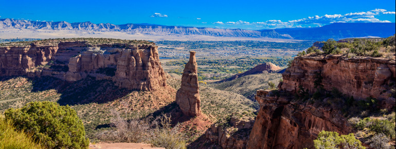
Westwards of Grand Junction, one may observe a highly impressive gorge landscape arising, pervaded with fascinating rock formations, shining red thanks to the sandstone they consist of. This is Colorado National Monument. The area encompasses a surface of 9,000 ha (90 km²) and has been a listed National Monument since 1911. It is therefore especially protected.
Colorado National Monument is located 1,970 ft (600 m) above the Grand Junction valley and the riverbed of the Colorado river. Not only can you enjoy the stunning landscape of the monument from here, but also have a fantastic view on the surrounding mountains, such as Book Cliffs and Grand Mesa, at the same time. The semi-desert contains eleven canyons in total and is not only a fascinating place due to the rather unusual rock formations, but also because of the deep gorges that were formed millions of years ago. Sticking out of the canyon, you find the 460 ft (140 m) high Independence Monument or the Coke Ovens. This reserve is also home to various animal species. Be on the lookout for mule deer, lizards and bighorn sheep.
If this is your first visit to Colorado National Monument, the Visitor Center might be the best starting point for you, which is about 4 mi (6.4 km) away from the west entrance. This is where you may receive information, learn more about the park, visit exhibitions or just purchase some souvenirs.
The best spot to have a perfect view from is the historic Rim Rock Drive. The road was built by the Civilian Conservation Corps done by manual labour in the 1930s, leading through the national park. You drive for about 23 mi (37 km) along the large gorges of the park, which you should take one hour into account for. Stopping by the numerous viewpoints (19 in total) will of course delay the journey. But this kind of delay one is certainly willing to take into account as the 19 viewpoints really offer spectacular views on the beautiful nature of Colorado National Monument. From all viewpoints the most popular are Cold Shivers Point, Ute Canyon View, Grand View, Independence Monument Overlook and Book Cliffs View.
You may also explore the area in several other ways. You have the choice between 45 mi (70 km) of hiking trails – ranging from easy to difficult routes – such as the Serpent's Trail or the Canyon Rim Trail. Some were already established in the beginning of the 20th century by John Otto, the first ranger of the national park. Cycling is popular here too! The Grand Loop trail, first instance, first leads via the Rim Rock Drive on a circular path before taking you back to the starting point on rural roads. If you wish to enjoy more of the beauty of nature on-site, you may find some rest at Saddlehorn Campground or get yourself a license at the Visitor Center to camp in the hinterland.
Historical Information
It took Mother Nature millions of years to form the landscapes of Colorado National Monument as we experience them today. On the ground of the canyon, rocks can be found that are estimated to be up to 1.5 billion years old. It forms a part of the Colorado Plateau, which the high plains of four US federal states belong to. The Grand Canyon is also located in this area.
Thanks to John Otto's commitment, Colorado National Monument is especially protected nowadays. The very same man fought for this special natural area to become a listed national park in the beginning of the 20th century. In May 1911, it became the 15th national monument in the United States with John Otto being its first ranger. He henceforth took care of the park for only a bug.
Interesting facts
- The day pass at Colorado National Monument is $15 making it one of the 5 cheapest tourist Attractions in the USA.
How to get there
By car
Travelling here by car, you first drive along Highway I-70.
Coming from the west, you leave via Exit 31 (Horizon Drive). Follow the signs taking you to the park's east entrance.
Coming from the eastern direction, you take Exit 19 (Fruita). You then head southwards on Highway 340. After about 3 mi (4.8 km) you will have reached the west entrance of the park.
By public transport
There are trains operating daily between Amtrak and Grand Junction. Additionally, the regional airport operates flights by the following airlines: Allegiant, American Airlines, Delta, United and US Airways.


