Contents
Route description
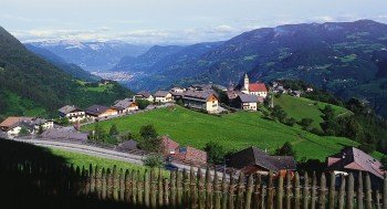
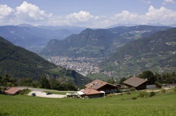
Beautiful hike with nice views of Collepietra and the valley of Bolzano/Bozen.Route: Collepietra (820m) path n. 2 – Ölkreuz – path n.8 Wiedenhof farm (802m) path n. 8B – hiking path of Collepietra n.6, n.7 (1201m) – Ölgartnerbild (1102m) – path n. 7, n. 2 Collepietra (820m).
Suitable for dogs
Eating options available
Interesting facts
- You're traveling a distance of 9 km on this moderate trail. The hike is therefore not too long. The average length of all hikes in South Tyrol is 12 km.
- You're facing an uphill climb of 526 vertical meters on this hike. The highest point of the track is 1,185 m above sea level.
- The trail is one of the dog friendly hikes in the region. (See all dog friendly hikes in South Tyrol.)
- In case of good weather conditions, the hike can also be done without bringing your hiking boots. There are places to buy beverages and food along the track. However it’s always recommended to bring enough water and food along with you.
Getting here
Take highwa's exit “Bolzano Nord/Eggental”, turn left direction Prato all'Isarco and than Collepietra/Steinegg. (about 20 min. from highway toll booth).


