Contents
Route description

The Caspar David Friedrich Trail in Saxon Switzerland covers almost 15 kilometers and leads to the places that inspired the famous Romantic painter. Along the way, you can expect varied landscapes, sweeping views, and fascinating insights into his art.
The Caspar David Friedrich Trail in Saxon Switzerland is a scenically varied route. It stretches over almost 15 kilometres. You should plan around five hours for a tour. The moderately difficult trail is also suitable for less experienced hikers. The hike is possible all year round. The circular trail starts in Krippen. There are twelve different information boards spread across the entire area. Paintings by the eponymous painter Caspar David Friedrich were created at these locations.
Following in the Footsteps of the Romantic Painter
The starting point is at the Caspar David Friedrich stele. Here you can learn interesting facts about the painter. From here, follow the road ‘Zum Mittelhangweg’. Next to one of the many information boards, a path leads up the hillside to the Mittelhangweg. At the top, turn left onto the Mittelhangweg. You can now follow this at a relaxed pace for 3.5 kilometres.
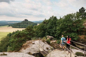
After the eighth information board, you cross the Hirschgrund over a bridge. The signposts here will help you to stay on the branched path. This is followed by an ascent to Schöna. There you can see a beautiful panorama over the Schrammensteine to Bohemian Switzerland. The following ascent leads to the Kaiserkrone. It is a little bit easier than the previous ones. At the top, you will find a plateau with various viewpoints.
The next stop is the Wolfsberg. The path there leads past a small idyllic pond. There is a small rest area on the Wolfsberg. From this point, a path leads down to Reinhardtsdorf. Past the church and after the path up the Krippenberg, you are on the final section. There are two more information boards here.
Germany’s Most Beautiful Hiking Trail 2025
The Caspar David Friedrich Trail in Saxon Switzerland has won the title of “Germany’s Most Beautiful Hiking Trail” in the annual public competition held by Wandermagazin.
Interesting facts
- You're traveling a distance of 15 km on this moderate trail. Average length of all hikes in Saxony is 50 km.
- Sturdy hiking boots are recommended on this track.
Highlights of the tour
There are twelve informationboards along the trail. These show the drawings made by the famous painter Caspar-David-Friedrich at the respective locations. A 13th information board can be found on the Elbe cycle path. Other highlights are the Mittelhangweg, the path to Wolfsberg, the Kaiserkrone and the Caspar-David-Friedrich-Stele.
The path to Wolfsberg offers a beautiful panorama. Here you can enjoy the view of the Schrammenstein and the Zirkelstein. The Kaiserkrone is special because this is where the first sketch was created, which the painter later used for his most famous work of art, the ‘Wanderer above the Sea of Fog’. The Caspar David Friedrich Stele marks both the start and end point of the hike. It is reminiscent of the historical signposts that provided the Romantic painters with orientation in nature.
Variations
Variation A: Follow the hiking trail to Schöna to the Kaiserkrone. From there, take the 252 bus from the village square in Schöna back to Krippen. Alternatively, you can also travel to Bad Schandau. There are nine of the twelve information boards on this route. The walk takes about 3.5 hours.
Variation B: Take bus 252 to the village square in Schöna and follow the signs to Wolfsberg. From there, continue to the Caspar David Friedrich stele in Krippen. This variant takes approx. 2 hours.
Equipment
It is advisable to wear sturdy shoes. If you want to hike along the trail in winter, you should use hiking poles and ice crutches strapped under your shoes.
Getting here
By car
There is a small car park near the starting point. There are other car parks scattered around the village.
By public transport
The ‘Krippen’ railway station is just 750 metres away. This can be reached with the S1 line of the Dresden S-Bahn.
The bus stop ‘Krippen - Alte Schule’ is 400 metres from the starting point. It can be reached by bus line 252 from the direction of Schöna or Schmilka.
Coming from Postelwitz, it is possible to take the ferry line F3. The ferry station ‘Krippen Ort’ is 200m away from the start of the hike.


