Contents
Route description

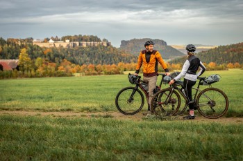
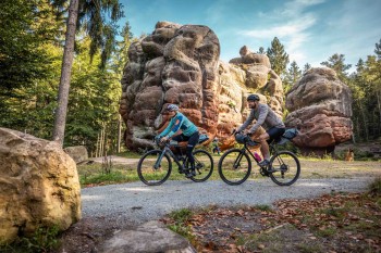
Steep ascents and rugged terrain, natural paths, and stunning panoramas – the Rockhead route is a real test for ambitious gravel bikers. As Saxony’s first official multi-day gravel bike route, it spans 320 kilometers, linking Saxon Switzerland and Upper Lusatia to create one of Germany’s longest tours purpose-built for gravel enthusiasts.
Seven stages - seven individual adventures
From the town of Wehlen in Saxon Switzerland via southern Upper Lusatia to the Zittau Mountains and back again - the Rockhead leads through some of the most beautiful and diverse regions of Saxony. There are an impressive 4,660 metres of elevation gain to overcome, spread over varied surfaces such as asphalt, forest paths and concrete slabs.
The tour is divided into seven stages, each of which can be ridden individually. With flexible starting points, the route can be tailored to personal preferences and schedules. Key access points include Bad Schandau, Sohland/Spree, Zittau, Löbau, Bischofswerda, and Stolpen. Each stage offers a unique experience: the green stage, for instance, winds through vast forests, offering a tranquil, nature-focused adventure, while the blue stage features wide, open sections under the expansive sky – perfect for those who want to pick up speed and cover distance. Ambitious riders can combine neighboring stages to create larger day projects, so-called loops.
The ideal time for a tour on the Rockhead is between April and October, as the route is usually easily passable during these months. In the winter, weather conditions, especially in the mountains, can lead to restrictions. Be sure to check current conditions beforehand to ensure a safe journey.
Digital Navigation on the Rockhead Route
A unique feature of the Rockhead route is its digital navigation system. Instead of traditional signposts, navigation is done exclusively via smartphone or GPS device. The GPX data for the route is available on the official website and can be easily downloaded. Alternatively, the tour can be planned and tracked directly through outdoor apps like Komoot or Outdooractive.
Well-equipped with Rockhead Starter Packs
For preparation for the tour, the Rockhead website offers starter packs that combine useful material with support for local nature. For each pack sold, €2.50 is donated to the Forest for Saxony Foundation. The Basic Pack includes a map of the route, stage cards with information about the sections, and a logbook. The Navigator Pack and the Adventure Pro Pack expand this equipment with practical extras such as a smartphone holder for the bike, an enamel mug, and a water bottle. All packs also include an access code for the community section of the website, available from 2025. Here, cyclists can share tour data and times, which can be recorded using QR codes placed along the route.
On the website, you can find further information, including tips on bike rentals and e-bike charging stations along the route.
Where to eat
Along the Rockhead route, cyclists can choose from various accommodation options. Whether under the open sky at one of the campsites or in a comfortable hotel or guesthouse, there’s something for everyone. Among the nine official Rockhead hosts are the Hotel Lindenhof in Bad Schandau, the Landhotel Riedel in Upper Lusatia, and the Berghof Oybin in the Zittau Mountains. All are particularly bike-friendly and provide essential services for gravel bikers. Those seeking a nature-focused experience will find a fitting option at the Ostrauer Mühle campsite in Saxon Switzerland.
Interesting facts
- With an overall length of 320 km the bike trail is currently the longest bike trail in Germany available on TouriSpo.
- There are places to buy beverages and food along the track. However it’s always recommended to bring enough water and food along with you.
Highlights of the tour

The Rockhead route passes through some of Saxony's most impressive landscapes and cultural landmarks. The canyon-like Elbe Valley and the bizarre rock formations of the Saxon Switzerland National Park region offer unparalleled panoramas. The Zittau Mountains Nature Park captivates with its towering peaks and diverse wildlife and plant life.
Cultural highlights along the route include the historic Stolpen Castle and the picturesque ensemble of Oybin Castle and Monastery. Charming villages with characteristic half-timbered houses and magnificent churches invite exploration, as does the UNESCO World HeritageSite Herrnhut, renowned for its rich history.
Getting here
The Rockhead route is easily accessible by both public transport and car. By car, major access points like Stadt Wehlen, Bad Schandau, Zittau, or Löbau can be conveniently reached via federal highways B172, B6, and B96. Additionally, the main towns are well connected by the S-Bahn S1 line (Meissen – Dresden – Bad Schandau – Schöna). The Bad Schandau National Park train station also offers long-distance connections from cities like Berlin, Hamburg, Leipzig, and Prague.
Locally, the guest card allows free use of trains, buses, most ferries in the region, and the Kirnitzschtalbahn. A key connection for the route is the ferry in Stadt Wehlen, with alternatives available in Kurort Rathen or at the Stadtbrücke in Pirna.
More detailed information can be found on the website.


