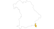
Webcam located at Blaueis mountain hut in Berchtesgaden Nationalpark, Upper Bavaria.
1 °C
3 days ago
The webcam shows the city Berchtesgaden which forms part of the popular holiday region Berchtesgaden-Königssee.
12 °C
38 minutes ago
Have a look at the nature bath Aschauerreiher in Berchtesgaden
14 °C
9 hours ago
You can see parts of the golf course Obersalzberg in the popular holiday region Königssee - Berchtesgadener Land.
10 °C
37 minutes ago
Enjoy the view of Vorderloiplsau looking southwest. You can spot Hochkalter and Reiteralm.
12 °C
48 minutes ago
Webcam located at Seeblick Hotel near Lake Thumsee in Bad Reichenhall
14 °C
57 minutes ago
Here you can see the mountain hut "Kessel-Alm" in Inzell
12 °C
temporarily unavailable
Outdoor pool of 'Rupertus Therme' in Bad Reichenhall, Upper Bavaria, small town near Salzburg.
16 °C
5 hours ago
Webcam located at Seeblick Hotel near Lake Thumsee in Bad Reichenhall
12 °C
57 minutes ago
From the Reichenhaller house (Staufenhaus) at the Hochstaufen you have a great view to the south towards the Lattengebirge. In the background you...
12 °C
47 minutes ago