Contents
Route description
This hike starts at Hotel Lugsteinhof. Swathe 30 takes you up Kahleberg mountain (905m/2,969ft), the highest point of the east Erz Mountains. From the viewing platform, you can see Freiberg, Drestden, and the Zittauer Mountains.
From Kahleberg to Geisingberg
After 500 metres along swathe 30, you get to I-Flügel. Cross swathe 31, then follow the trail Zaunhäuser Weg. You get to the summer toboggan located at the centre of Altenberg. Afterwards, walk along Rehefelder Straße to B170, which you cross. Dippoldiswalder Straße meets the hiking trail to Geisingberg mountain just before the railway crossing.
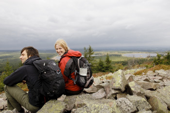
From here, start your way up the former volcano. At the peak (824m/2,703ft), you find Luisenturm tower, which is more than 100 years old. Climbing the stairs is wort it - from here you get a breathtaking view of the region, and in good weather you can see as far as to the Giant Mountains. Afterwards, walk downhill to Geising, where you can explore the historic town centre. Continue past Gründelstadion. Follow the road to Zinnwald, before turning left onto the hiking trail to Kohlhaukuppe.
Panorama on Kohlhaukuppe
Your climb to the summit at 786m/2,579ft is rewarded with another great panoramic view. From there, keep towards Zinnwald. The trail leads you right to the Czech border. In Zinnwald, you walk to the bus stop Grenzsteinhof. The the left, Hochmoorweg trail starts, which leads up to Zinnwald's weather station. After about 300 metres, you get back to where you started.
Where to eat
The hike features various opportunities to get a bite to eat. Hotel Lugsteinhof offers cold food to gain strength before you set out, or regional specialities to reward you when you come back. At the beaks of Kahleberg, Geisingberg and Kohlhaukuppe, you can also find mountain huts. If you have a vampire to ward off, Kohlhaukuppe is the place to go - there is a reason why it is also known as Knoblauchkuppe (Knoblauch means garlic!). Moreover, you can find several restaurants in Altenberg and Geising.
Interesting facts
- With an overall length of 17 km the hike is among the 3 longest hikes in Saxony available on TouriSpo.
- Three-Mountain Tour: Kahleberg - Geisingberg - Kohlhaukuppe is among the 3 best rated Hikes in Saxony.
- Elevated between 594 m and 899 m, the hike is among the 3 highest elevated hikes in Saxony. You're facing an uphill climb of 479 vertical meters on this hike. This makes the Hike the one with the largest ascent in Saxony.
- You shouldn’t forget to bring your hiking boots. There are some sections on the trail where sturdy footwear is required. If you get hungry along the way, there are places to rest and get food. Nevertheless it’s recommended to also have enough water and food in your backpack when hiking or biking.
Highlights of the tour
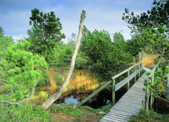
This hike boasts a beautiful panorama from the Erz Mountains over its surroundings. In good weather, you can see all the way to Snow Mountain in the Giant Mountains. Another higlight is the high moor in Georgenfeld, which emerged around 10,000 years ago. It was declared a natural reserve in 1926, and offers a safe home for numerous plants. Furthermoer, you an visit the historic town centre of Geising.
Getting here
By car
You can reach Altenberg via motorway A17, which you leave either at exit Dresden Südvorstadt or Bad Gottleuba. From Dresden, take B170 past Dippoldiswalde to Altenberg, from Bad Gottleuba you get to Altenberg via Liebenau and Lauenstein. At the town, drive towards Zinnwald/Georgenfeld. Leave B170 at the street Neugeorgenfeld, which leads you to the start of the hike.
Public transportation
From Dresden, S1 and S2 trains go to Heidenau. There you change onto RB72, which goes to Altenberg. Furthermore, a bus goes from Dresden to Zinnwald Grenzsteinhof, which also calls at Altenberg railway station.


