Contents
Route description
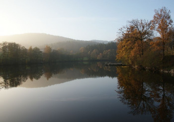
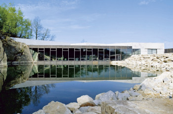
The hike starts at Granitzentrum Bayerischer Wald in Hauzenberg near Passau. The trail leads you past the town of Hauzenberg, through Bürgerpark and along Staffelbach river. After you have crossed Passauerstraße, you get to Freudensee lake, from where you can walk a little detour to see the eponymous quarry. From the lake, ascend via Lindbüchl and Neustift to Oberfrauenwald. As an alternative, you can walk to Oberfrauenwald viewing tower here. The tedious detour is rewarded with a beautiful panoramic view from the 27m high tower.
Next you get to the small town of Geiersberg. You are already past the half way mark. The popular sun alp is perfect for a well-deserved break. The second leg of the stage leads you to Obernreuth and Schauberg and all the way to the town of Sonnen, usually on asphalted roads. Detailed information boards along the way show the deep connection of the region with granite. At the destination, you can get a bus back to Hauzenberg. Get off at 'Post', which is the bus stop closest to where you started.
Where to eat
There are numerous pubs and inns along the way whee you can get a bite to eat, such as Sonnenalm Geiersberg or Landgasthof Gidibauer.
Interesting facts
- You're traveling a distance of 20 km on this moderate trail. Average length of all hikes in Bavaria is 50 km.
- You're facing an uphill climb of 876 vertical meters on this hike. The highest point of the track is 896 m above sea level.
- Make sure to bring sturdy footwear on this track. Hiking boots are highly recommended. If you get hungry along the way, there are places to rest and get food. Nevertheless it’s recommended to also have enough water and food in your backpack when hiking or biking.
Highlights of the tour
- Granitzentrum Hauzenberg offers you insight into the traditional granite workmanship. Film screenings and exhibitions teach you all about the stone.
- Freudenseebruch is a quarry known as the origin of the gigantic pillars that were broken to build the Hall of Liberation in Kelheim.
- At Observation Tower Oberfrauenwald, you enjoy a panoramic view of Dreisessel mountain and the Dreiburgenland region.
Getting here
Coming from motorway A3, cross the city centre of Passau towards Czech Republic. Follow river Danube and B388 towards Obernzell, then turn onto St 2132 towards Hauzenberg. After a while, you get to the town, where the Granitzentrum is located right as you enter the town, on your right-hand side.


