Contents
Route description
Mountain bike experience and a good condition are prerequisites for this route.
The history of alpine life
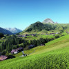
The starting point of the bike tour is the church in Schröcken. On the following 22 kilometers, a high-alpine and demanding route awaits you. From Schröcken you take a forest path up to Batzenalp. You will pass the "Alpmuseum uf'm Tannberg". The road from the "Alpmuseum" to the "Auenfeldalpe" runs along the wildly romantic Auenfeld, where the source of the Bregenzerach is located.
An important commodity
Now follows one of the demanding sections of the route. From the Auenfeldalpe you go over the Salobersattel to the Hochtannbergpass. Continue on a gravel path past the Hotel Adler and Ski- & Wanderhotel Jägeralpe. There you can take a break and strenghten yourself with regional food. then we continue on the "Alte Salzstraße" to Warth.
Where to eat
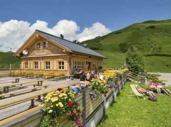
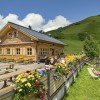
With the Auenfelder Hütte, the Hotel Adler and the Ski- & Wanderhotel Jägeralpe as well as the catering establishments in the villages of Schröcken and Warther there are several refreshments available. All offer Austrian specialities.
Interesting facts
- You're traveling a distance of 22 km on this moderate trail. The average length of all bike Trails in Vorarlberg is 35 km.
- bike tour: Schröcken - Auenfeld - Hochtannbergpass - Warth is among the 10 best rated Bike Trails in Austria.
- Elevated between 1,260 m and 1,792 m, the bike trail is among the 15 highest elevated bike Trails in Austria. You're facing an uphill climb of 914 vertical meters on this bike trail. This makes the bike trail one of the 15 bike Trails with the most ascent in Austria.
- There are places to buy beverages and food along the track. However it’s always recommended to bring enough water and food along with you.
Highlights of the tour
"Alpmuseum uf'm Tannberg"
A highlight ist the visit of the "Alpmuseum". The exhibition shows the life in the alps of today and 500 years ago.
The museum is open on Tuesday, Thursday and Sunday from 01.00 - 04.00 pm.
"Alte Salzstraße"
On the "Alte Salzstraße" the path of the "White Gold" can be followed today. The salt was a valuable commodity in the 15th century.
Variations
The tour is available in two versions. Either you start in Schröcken or in Warth. Both variants are challenging but scenically very beautiful.
The part "Auenfeld - Salobersattel - Alte Salzstraße" can be replaced by driving on road L200.
Those who want to cycle back from Warth to Schröcken or from Schröcken to Warth, take the L200 road.

