Contents
Route description

Start point in the green valley
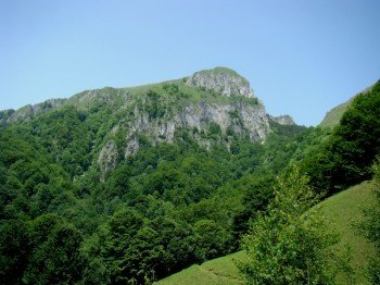
The actual starting point of your hike is the Pahomie Hermitage. From here you walk down the road through the forest and reach Pătrunsa Hermitage. You will then reach a spring where the path markings indicate the beginning of the trail. Since the hike is generally regarded as more challenging you will also run steeply uphill right from the start. From the original junction, walk up the ridge for 15 minutes before descending a little further to the edge of some of the cliffs. After having crossed the following valley, you continue along a small forest path that leads you to the next valley. This is however particularly green and shows itself with its flowers and other plants from its best side. You cross this completely within half an hour and reach the upper side of the valley.
Over the ridges high up
Now you have to cross the slope at the end of the valley and after another half hour you will reach the edge of the forest again. Afterwards you arrive at a clearing with two sheep's hawks and a small spring in the background. You keep left here and reach the alpine meadows in front of you relatively quickly this way. You now walk between a spruce forest and the peaks of Vânturariţa and Vioreanu. After another three-quarters of an hour of strenuous ascent you have reached the next ridge. Here you can also take a short break and have a look at the beautiful view from a small stage destination. The ascent continues until you reach the high plateau of Vânturariţa after some time. Also here you should not miss the panorama view and take another breather. Then you keep on the way in a northwesterly direction and reach the Ştevioara pass, which is 1790 m above sea level. To help you find your way around, you'll also find the marker for trail number 11 here, which you can also follow to the end of the hike.
Where to eat
As there are no bigger possibilities for resting on the hike, you should always take your own provision with you here.
Interesting facts
- You're traveling a distance of 3 km on this moderate trail. The hike is therefore not too long. The average length of all hikes in Romania is 18 km.
- Elevated between 880 m and 1,786 m, the hike is among the 3 highest elevated hikes in Romania.
- Make sure to bring sturdy footwear on this track. Hiking boots are highly recommended.
Video
Highlights of the tour

The tour offers on the one hand a challenge for every passionate hiker, because the route is permanently steep uphill, so that you should bring some fitness with you in any case. Due to the altitude you will have a unique view of the surrounding valley and you can use the opportunity to make small stops to take a closer look at the surroundings. In addition, you will find a special feature right at the beginning of the tour, because here is the Pahomie Hermitage, which is with its location directly in the rock optically in any case a highlight on the hike.
Getting here
By car
From Târgu Jiu
You leave the city centre via DN67 in the direction of Copăcioasa and follow it for about the next 90 km. At the next crossroads turn left onto DJ646A and after a few metres change to DJ651, which you follow until you reach the crossroads with DN64A. Keep left and turn left at the next opportunity onto DJ654, which will take you directly to the starting point of the hike.
From Pitești
You drive over the DN7C in the direction of Uiasca out of town and at the next opportunity turn left at the roundabout onto the DN7. Follow it for the next 54 km until you reach Râmnicu Vâlcea. You cross the city and continue your journey over the DN64A. Then turn onto DJ654, which takes you directly to the starting point of the hike.
From Sibiu
You leave the city via DN1 in the direction of Șelimbăr until you meet DN7 and follow it for the next 80 km. When you reach the first foothills of Râmnicu Vâlcea, turn left onto DN64A and change to DJ654, which takes you directly to the starting point of the hike.


