Contents
Route description
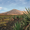
To start the tour drive from the national road FV-101 onto Calle de Los Geraneos while the mountain Escanfraga emerges in front of you. With its 529m height it is the highest vulcano on Fuerteventura. Continue about 600 m until you pass the last houses of Villaverde and turn onto a non-tarred road. Now you will pass by some mountains. First to the left mountain Negra, behind that Pajarita and Calderas Blancas. Directly in front of you but still a long distance away is Roja and to its right Caima.
Afterwards you will pass many unplanted fields, which as well as agricultural used stonewalls to define territory, show the traditional agriculture of the island.
Continue further till Rosa Erguida and pass two fountains. Now you will pass another stonewall, then turn left.
After a small turn you will get to a slightly destroyed stonewall . This time turn right. During the next turn watch out for the old farm.
Now follow the mountain Caima, take the new highway and drive towards Llano de Caima, the plain of Caima. Continue towards the ravine of Lomo Cumplido, where you will see fossils from the Pleistocene (1.7 to 0.4 million years ago).
Finally drive alongside the shore to Parque Holandes, the final destination of that tour.
Interesting facts
- You're traveling a distance of 9 km on this moderate trail. The bike trail is therefore not too long. Average length of all bike Trails in the Canary Islands is 13 km.
- If you get hungry along the way, there are places to rest and get food. Nevertheless it’s recommended to also have enough water and food in your backpack when hiking or biking.
Highlights of the tour
Highlight of this tour are the agricultural relics from earlier times.
Video
Getting here
By public transport:
It is generally easy to get around on Fuerteventura by public transportation. For the latest bus timetables visit Thiadhe's webpage.
Or rent a car with one of many local companies.


